


SAMHSA roster as pulled November 16, 2026
How far is treatment from each Connecticut county?
Our starting points: the centers of Connecticut's 9 counties. From each, we measured the miles to three things: the nearest medicine clinic, live-in program and detox. In 0 counties, 0 residents live more than 30 miles from any detox.
Before you dial, locate two things for whoever needs care: the insurance card and the ZIP code. This referral line is paid for: a partner answers, not any program on this list.
All 9 counties
Counties ranked by miles to their nearest detox. Miles here are as the crow flies; by road, expect more.
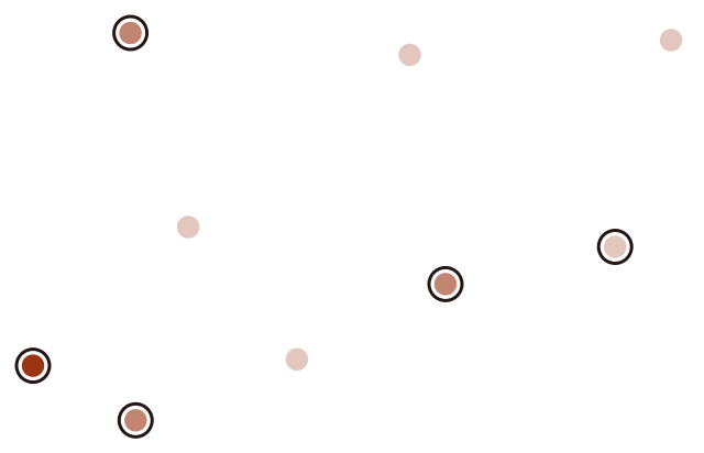
- up to 10 mi 5
- 10–20 mi 3
- 20–30 mi 1
- Farthest: Western Connecticut Planning Region 27 mi, Greater Bridgeport Planning Region 16 mi, Northwest Hills Planning Region 12 mi, Lower Connecticut River Valley Planning Region 11 mi, Southeastern Connecticut Planning Region 9 mi
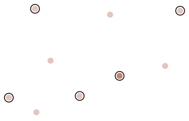
- up to 10 mi 8
- 10–20 mi 1
- Farthest: Lower Connecticut River Valley Planning Region 12 mi, Western Connecticut Planning Region 8 mi, Northeastern Connecticut Planning Region 7 mi, South Central Connecticut Planning Region 5 mi, Northwest Hills Planning Region 5 mi
| County | Population 2024 | Facilities inside county borders | Detox, mi | Residential, mi | MAT, mi |
|---|---|---|---|---|---|
| Western Connecticut Planning Region | 637,013 | 24 | 26.7 | 7.9 | 5.0 |
| Greater Bridgeport Planning Region | 335,666 | 21 | 16.4 | 1.0 | 0.6 |
| Northwest Hills Planning Region | 114,101 | 15 | 11.6 | 4.9 | 4.9 |
| Lower Connecticut River Valley Planning Region | 177,540 | 13 | 10.9 | 11.6 | 10.9 |
| Southeastern Connecticut Planning Region | 282,602 | 27 | 9.1 | 1.5 | 0.8 |
| Capitol Planning Region | 991,508 | 46 | 5.9 | 3.1 | 3.5 |
| Northeastern Connecticut Planning Region | 97,701 | 7 | 5.0 | 6.9 | 5.0 |
| South Central Connecticut Planning Region | 576,718 | 32 | 5.0 | 5.0 | 3.6 |
| Naugatuck Valley Planning Region | 462,220 | 27 | 3.7 | 3.6 | 2.7 |
Undecided where to begin?
Deciding between programs? One option is to contact a listed program yourself; the other is the referral line below.
This referral line is paid for: a partner answers, not any program on this list.
Method
Facility data: all Connecticut listings on SAMHSA FindTreatment.gov that list substance use care or detox, November 16, 2026 snapshot. County center points come from the Census Bureau's 2024 Gazetteer. Population counts: 2024 Census estimates. ZIP code decides which county a facility falls in (Census ZCTA-to-county file). We measure distance in great-circle miles, starting at each county's internal point and ending at the coordinates a facility reports; for SAMHSA listings missing coordinates, we geocode the address with the Census Geocoder, falling back to the ZIP code center if there is no street. MAT, or medication treatment, here also takes in certified opioid treatment programs (OTP). Reuse of the data is welcome; just link back here.